GWYDIR VALLEY IRRIGATORS ASSOCIATION
Historical Water Availability
GWYDIR VALLEY IRRIGATORS ASSOCIATION
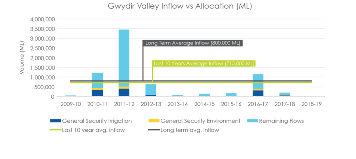
The Gwydir Valley is considered a valley with a low level of water reliability driven largely by the low average yield of general security entitlement and the low volumes of other, more secure forms of water.
The following graph provided by WaterNSW in their operations update, outlines the inflows and allocations over the past 10-years. Water is allocated to various accounts (as per the water sharing plan rules) when it is available and stored for use at a later time but as displayed by the graph, not all water available is allocated due to limitations on access.
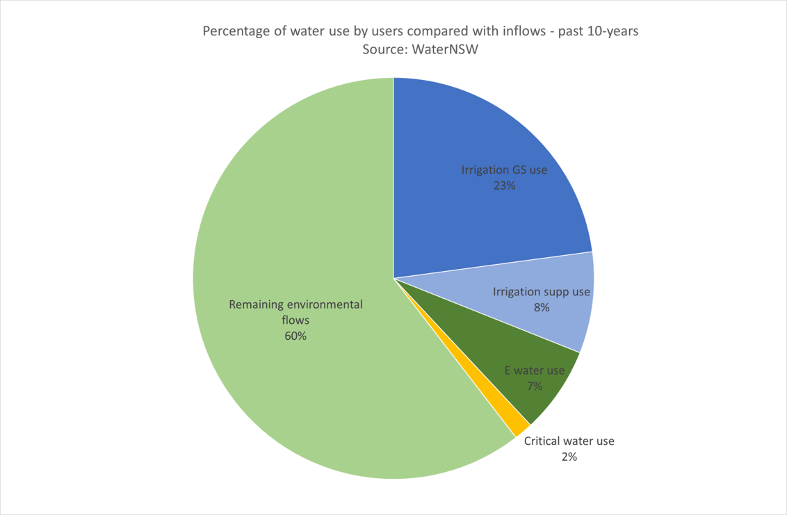 WaterNSW as part of drought
communications, recently reviewed non-critical water access over the last 10-years against inflows into the catchment and determined that
irrigators have had access to 23% of the known inflows into the system. This percentage excludes water allocated to the environment
licences.
WaterNSW as part of drought
communications, recently reviewed non-critical water access over the last 10-years against inflows into the catchment and determined that
irrigators have had access to 23% of the known inflows into the system. This percentage excludes water allocated to the environment
licences.
A breakdown of the historical water availability for the valley is provided below. For further details on water licence numbers, allocations, usage and other statistics, see either our overview on Water Available for Irrigation or the NSW Water Register managed by DPI Water.
Yearly summaries by the GVIA are provided on our separate webpage 2019-20, 2020-21 or for long-term historical records below.