GWYDIR VALLEY IRRIGATORS ASSOCIATION
GWYDIR VALLEY IRRIGATORS ASSOCIATION
Good information informs good debate and better decisions. There has been much misinformation about floodplain harvesting, its opportunity and impact to rivers and downstream communities. On this page we try to address these key misconceptions using publicly reported and researched data, backed up by evidence.
We don't speculate, we research and analyse and then summarise this because facts matter.
We address the following common claims:
Slattery and Johnson in their 2021 report 'Floodplain water harvesting in the Northern New South Wales Murray - Darling Basin' which was jointly funded by a range of groups, including Southern Basin Connected Communities, Australian Floodplain Association and Southern Riverina Irrigators. Many of these groups continue to prosecute this argument and is evidenced in submissions into the NSW Select Committee Inquiry into Floodplain Harvesting and evidence by witnesses at the hearing including Marryanne Slattery and Chris Brooks.
These limits are being misrepresented by not comparing like for like and ignoring their purpose which is to establish scenarios to
assess and compare total diversions to determine the lowest legal limit.
Modeling results to-date do not indicate that the NSW Government is intending to change any Cap calculations. In some valleys, an
update Baseline Diversion Limits for the Basin Plan maybe be required using the process of accreditation of Water Resource Plans used by
other states.
Spotlight on the Gwydir Valley
In the Gwydir, the model improvement program has lead to the volumetric representation of some of the legal limits changing from new
information.
This information HAS NOT changed the overall limits of Cap, with new information mainly climate data, it has gone down.
.png) * These two scenarios, compare the cap conditions across the same climatic sequence. This is a like
for like comparison.
* These two scenarios, compare the cap conditions across the same climatic sequence. This is a like
for like comparison.
**This scenario is the HFP updated model run but extended to include new climate information. Exempt and non-exempt rainfall runoff is
combined.
The accredited Cap total diversions is 447GL/yr the regulated diversions of High Security, General Security and Supplementary volumes combined is 339GL/GL in Appendix H, table 4.2 of Gwydir Valley Independent Audit of Cap Model by Brewsher, April 2009.
A request by Gwydir Valley Irrigators for a like for like comparison of Cap using the same climatic sequence confirms, there is no change in Cap overall diversions, despite the updated improvements. This was provided after concerns about the significant downward revision in Cap that we raised during consultation.
The results presented in consultation reports in March, present total diversions as 431.4GL/year with regulated diversions of High Security, General Security and Supplementary volumes combined being 327.7GL/Year both comparisons, are actually a decrease of Cap.
The Healthy Floodplains Project will likely result in a requirement to amend the Baseline Diversion Limit for the Gwydir Valley. That's because of the work by the Healthy Floodplain Project to better represent on-farm infrastructure, scale down irrigation nodes to the farm-scale rather than reach-scale and access to floodplain flows from the floodplain inundation modelling has been incorporated into the model (this is all described in the Model Build report). Now that modelling updates and improvements are finished, this process can be initiated through the accreditation of the Water Resource Plan for the region.
What are legal limits and why can then change?
Legal limits can be one of three option now in NSW - Cap, Plan Limit or Sustainable Diversion limit. Whilst the calculation
method for each is fixed (in legislation), the volumetric representation of the limit of total water extracted and is subject to change
with new information, this could be as simple as extending the climatic period of calculation to capture recent data. There are
separate government processes to update these limits.
It appears that the contention is not that 'legal limits must be adhered' but rather the misrepresentation of the limit that was once defined.
In NSW law, Water Sharing Plans for each region define legal limits by the lesser of the Murray Darling Basin Ministerial Cap on Diversions or the long-term annual average extraction limit (LTAAEL), as determined by hydrological models. The required calculations for MDB Cap is included in Schedule E of the Murray Darling Basin Agreement (Schedule 1 of the Water Act 2007) and include floodplain harvesting. The required calculations for the long term annual average extraction limit are in the valley specific water sharing plan and in the Gwydir for example, also include floodplain harvesting.
This is explained by the MDBA in their fact sheet, saying “Floodplain harvesting has been included in the Murray–Darling Basin Agreement’s Cap on surface water diversions (the Cap) since 1995, and is likewise included as part of the baseline diversion limits and sustainable diversion limits (or ‘SDLs’) imposed by the Basin Plan. Limits imposed by the Cap (and SDLs) are an overall limit for all forms of take and do not on their own regulate individual methods of taking that water—as long as overall limits are not breached.”
Since 2012 Commonwealth requirements are also established as part of the Murray Darling Basin Plan, this sets a third limit called the sustainable diversion limit. The NSW Government below explains has these limits have reduced the volume of water available to extraction. Our page, 'History of Water Reform' as summarises this.
These limits (the Cap, the long term annual average extraction limits and the SDL) are not the same number, they are a set of conditions that represent a scenario and they are used comparatively not as absolute volumes.
That's because these limits are actually formula derived. This is purposeful and allows for new information such as updated climatic information to define these limits or changes in policy and sharing arrangements. There are processes to update and amend these limits, for both Cap, the Plan Limit and the Baseline Diversion Limit. This is explained in the NSW Government fact sheet 'How surface water limits are defined' and demonstrated in the NSW Government graphic below .
.png)
To properly compare these limits you must ensure you compare apples with apples, and compare scenarios using the same climatic sequences and policy settings e.g. for rainfall runoff and, compare overall diversions, not the category of diversions to each other. This is often overlooked when using published reports at a point in time, to compare updated outcomes.
The NSW Government explains in their fact sheet 'An overview of legal limits' that "floodplain harvesting will be licensed such that overall surface water take will be within legal limits. In valleys where floodplain harvesting has caused legal limits to be exceeded, licensed entitlements will reduce take."
After developing models and water sharing plans since the 2000s, finally in 2009 many of the major inland cap models were accredited by the Murray Darling Basin Commission. Its important that the model is accredited, not the outcome of the model as it can be subject to change from new climatic information for example. Water sharing plans and long-term extraction limits were already in place in most of the regions by this time, these do not need accreditation but rather are Ministerial decisions. These decision now need concurrence from the Minister for Environment.
In 2012 with the Basin Plan, the MDBA made minor amendments and updated the climatic period for NSW valley based hydrological models. This information formed the Baseline Diversion Limit and included what was estimated then as the long-term estimate of floodplain harvesting. This number is 46,000 ML/year and is often the quoted as the Cap. This is not the Cap for floodplain harvesting this is the Baseline Diversion Limit estimate of one type of diversion within the valley diversions, used to inform the Sustainable Diversion Limits for the Basin Plan as represented in this table by the MDBA. This number also does not reflect the NSW Water Management Act definition of overland flow to include rainfall run-off and therefore, comparisons of this number to NSW modelling, is not appropriate
The correct use of this number would be to say: that at the time of the Basin Plan, it was estimated in NSW water sharing plans with a model run to 2009 that 46,000ML/year of floodplain harvesting was estimated to occur with 478,000 ML/year of rainfall run-off harvesting (not for basin landholder rights) in the NSW northern basin. Since this model run, the WMA has been amended to include rainfall run-off as floodplain harvesting and a portion of this rainfall run-off is also now to be represented as floodplain harvesting in NSW. NSW is now going through finalisation of these updated models for accreditation by the MDBA as indicated by modelling updates in the Gwydir, Border Rivers and Macquarie Rivers.
It is recognised by the NSW and Australian Government's that information and knowledge around floodplain harvesting and rainfall run-off process can be improved in models and the Healthy Floodplains Project investment will undertake these necessary model improvements.
Since 2012, NSW with Commonwealth funding have updated and reconfigured the northern basin valley based models as part of the Healthy Floodplains Project. This new information has resulted in updated outcomes from the comparison of these scenarios and included an updated, current conditions which represents diversion in 2019.
Updating the volumetric legal limit is not new, in fact there are many valleys that have updated there limits right around the Basin
including in Victoria and South Australia. This is explained on the MDBA page 'Current
Diversion Limits'.
If we do not accept that new information can improve these limits, then we undermine decision making with out-dated information. The implications of locking in data must be considered when we know all regions have changed their development characteristics since the 2000; irrigation practices have altered to address efficiency and environmental provisions, crop choice for example. This is critical when we consider how we may need to make water policy decisions to adapt to climate change.
As far back as 2019, some groups have speculated the total volume of floodplain harvesting take by northern irrigators. This
number was reported in newspapers like the the Sydney Morning Herald, the Land and the Barrier Truth as once
being 3,000,000ML, although one letter to the editor article reports at least 4,000,000ML. Lately, it is speculated 2,000,000ML
as in submissions into the Select Committee Inquiry into Floodplain Harvesting by Southern Riverina Irrigators, Southern Basin Connected
Communities.
These numbers are pure speculation and are mathematically impossible. The NSW Government has not finalised the Healthy Floodplains Project modelling for all valleys, so the total unrestricted volume or proposed licensed volume is not yet known.
What we do know is through the Healthy Floodplains Project the NSW Government has surveyed and ground truthed all irrigation storages in the northern basin and determined this volume to be 1,292,000 ML (reported in the assessment of take in the northern basin first flush). Slattery and Johnson in their 2021 report 'Floodplain water harvesting in the Northern New South Wales Murray - Darling Basin' also undertook a similar storage analysis, which determined 1,395,000ML of on-farm storage, substantiating the Government's analysis.
With all floodplain harvesting take needing to end up in a storage. It is mathematically, impossible for irrigators in any single flood event to take more than the storage capacity. They would need to fill their storages, use all this water and re-fill these storages to by physically able to access any of these speculated numbers. These claims do not add up.
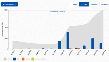
The Gwydir is the most developed valley in terms of on-farm infrastructure (see below summary from the modelling scenarios report). The modelling in the Gwydir has been completed and the current development conditions finalised as part of the program. This determined that there is 523,261ML of permanent on farm storage and 28,996ML of temporary storage that can be used to store all sources of water, not just floodplain harvesting (see below table).
The licensing proposal was to issue 108,000 unit shares to eligible floodplain harvesting (assumed exemption for rainfall runoff), which is less than 20% of the total on farm storage in the valley. This means, every eligible floodplain harvester would have to accumulate their maximum allocated water to be able to fill all their storage with just floodplain harvested water, which is unlikely given rainfall run-off would need to be captured and supplementary water would also be simultaneously available. This is one of the reasons why ‘500% carryover’ was proposed, because it takes everyone of those 5 years to accumulate what would be 100% of the irrigators’ share (i.e. the licence size was made smaller, so that it takes 5 years to accrue your full allocation).
.png)
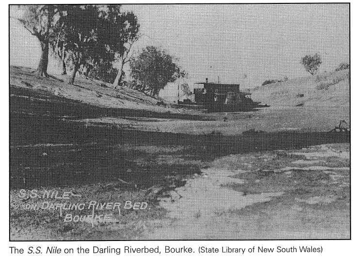
This claim has often been reported during the drought and around the time of the Menindee Fish Deaths in 2019, as in The Land
"Floodplain dilemma" and "Floodplain plan condemned" in the Barrier Truth and the Advertised open letter to the Hon.
Niall Blair, Minister for Regional Water in 2019.. This claim is one of the key underlying premises contained within the
Australia Institute report "Owing down the river - The Barwon-Darling/Barka River is dry. But almost 2,000 gigalitres have been
consumed by the irrigation industry this year while nothing has flowed to Menindee Lakes" whose authors were Marryanne Slattery,
Bill Johnson and Rod Campbell.
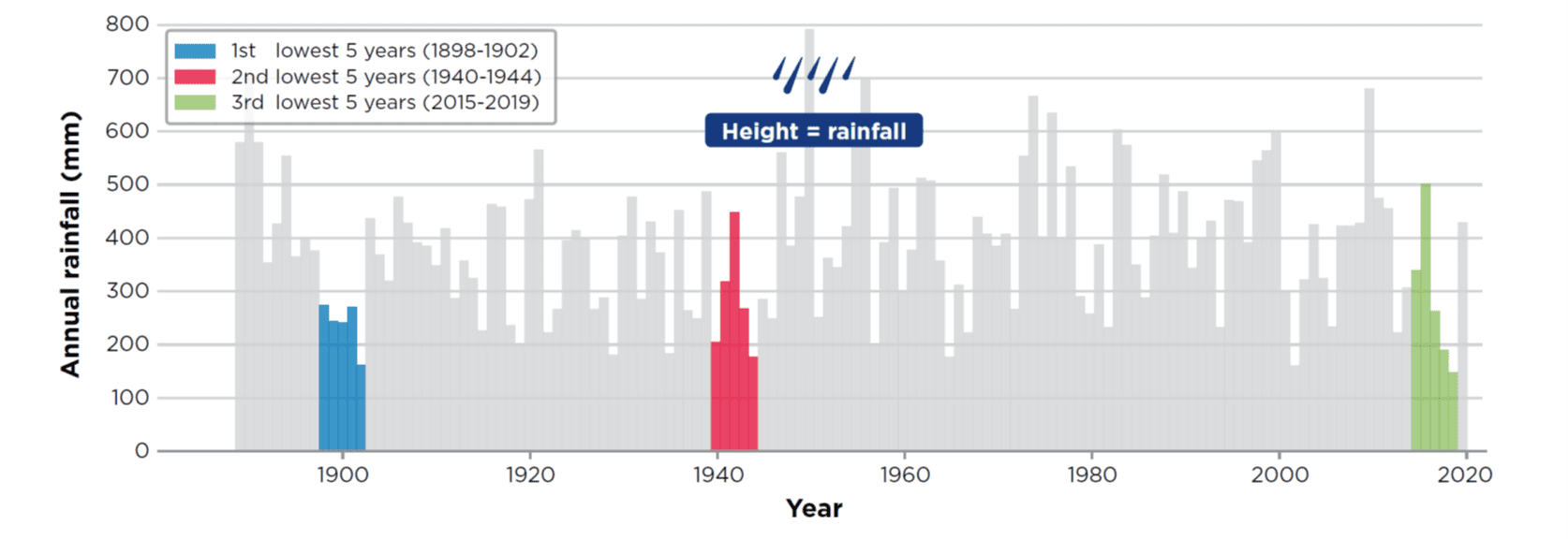
This overarching statement is overly simplistic in its assessment. A constantly flowing river is not normal for the
Barwon-Darling region. The river stopped flowing for extended periods even before there were large dams and significant agricultural water
use upstream. Reduced river flows is a function of a complex interaction of factors including rainfall, temperature, land-use
change and development, not just irrigation develop or floodplain harvesting. ”
This was outlined within the summary and Final Independent Panel Report into Fish Deaths in the Lower Darling saying "Drought conditions in the Northern Basin have had a major impact on inflows. After the 2016 high inflow event, there were no further inflows into the Menindee Lakes. Low or no flows, combined with extended hot and dry weather conditions, resulted in poor water quality conditions". The later report by the Interim Inspector General report reconfirmed this but also went onto explain that “Inflows both into the Menindee Lakes and from the Lakes to the River Murray have dramatically reduced in the last 20 years. There may be numerous factors contributing to this, including record low inflows in northern NSW, lower rainfall, higher temperatures, catchment modification (including farm dams), increasing development, floodplain harvesting, changes in extraction rules in water-sharing plans, and non-compliance. The Inquiry heard that understanding the relative influence of each of these factors is highly complex and has not been established.”
The influence of floodplain harvesting is limited by the fact, floodplain harvesting occurs when rivers and floodplains are at full capacity and overflowing. The NSW Government in this factsheet 'Floodplain harvesting and cease to flow events in the Barwon Darling' could not find any evidence to support this claim.
The conclusions stating "during the 30-year period covered by this analysis, there is no evidence to support a proposition that floodplain harvesting is occurring during cease-to-flow events and could be considered to be contributing to either starting the cease-to-flow period sooner, or extending the event in a meaningful way. During periods when floodplain harvesting is occurring with similar timing as cease-to-flow events, that floodplain harvesting accesses a portion of the flow event and the remainder continues downstream to relieve the cease-to-flow conditions which are occurring."
The NSW Government also have this factsheet 'River Flows and climate' that provides evidence (below) that the "Barwon-Darling River ran dry for significant periods before there was any floodplain development. There is also evidence to indicate that the practice of floodplain harvesting is not making this worse. While development can affect river flows, climate causes the river to run dry for extended periods."
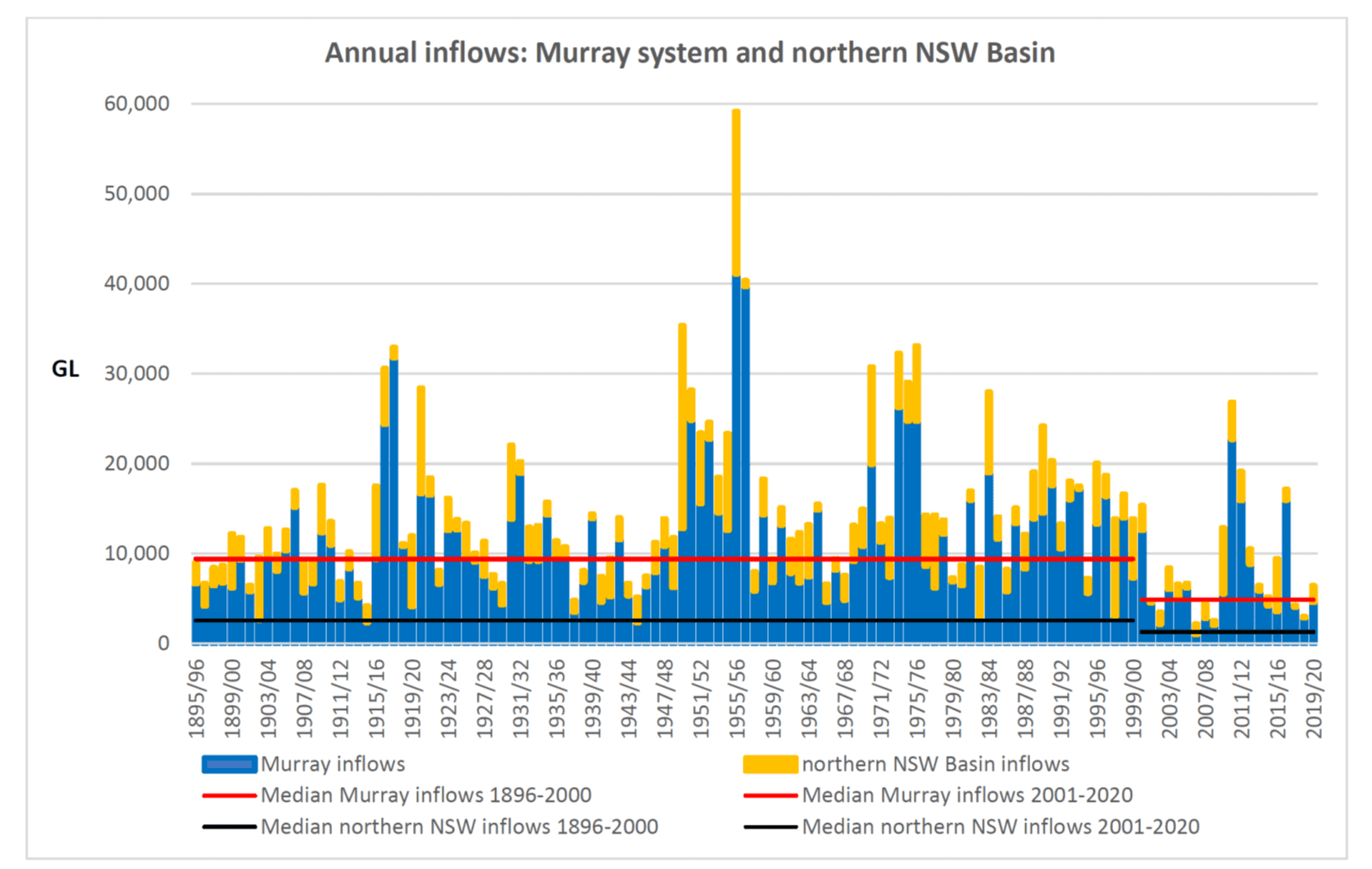
However, many reports have determined that inflows right around the Murray Darling Basin, upstream of irrigation communities and downstream of them have all declined and more so, in the recent 20-year history. This was one of the main conclusions of the Interim Inspector General’s report into the impact of lower inflows on state shared under the Murray-Darling Basin Agreement.
Analysis of the publicly available inflow data from the Murray and northern NSW Basin below by NSWIC demonstrates this downward trend evidence in their submission into the Select Committee Inquiry into Floodplain Harvesting.
Even the Wentworth Group of Concerned Scientists in recent (and rather
flawed as responded to by the MDBA)
assessment of the Murray Darling Basin observed versus planned flows,
identified reduced inflows and indicated several reasons.
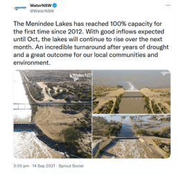
The claim that FPH stops the Barwon and Darling Rivers grabbed attention during the drought but ignores the reality in the Northern Basin right now. Currently, Menindee Lakes are at full capacity, the northern rivers have largely freely flowed since March 2021 . Some valleys have had floodplain harvesting opportunity.
This can be all evidenced by various satellite images and data from WaterInsights (below snapshot) and all while floodplain harvesting is occurring.
This linear relationship is the premise for this claim was reported in Slattery and Johnson in their 2021 report 'Floodplain water
harvesting in the Northern New South Wales Murray - Darling Basin' which was jointly funded by a range of groups, including Southern Basin
Connected Communities, Australian Floodplain Association and Southern Riverina Irrigators whom continue to prosecute this argument.
There is not a linear corelation between increased storage volume and floodplain harvesting take as storages are used for a range of purposes not just floodplain harvesting.
Increasing capacity to store is not the only driver of growth of floodplain harvesting, this is evident right around the Basin where on-farm storage have grown in response to best management practices for efficiency and environmental requirements.
While total extraction in some valleys has grown above legal limits it is not only because of on-farm storage.
The NSW Government explains this in their FAQ section why are there so many on-farm storages that "Floodplain harvesting opportunity doesn't occur every year. Therefore, when considering development changes in the northern basin, 1 megalitre of increased storage does not equal 1 megalitre of additional floodplain harvesting. All changes in development conditions and resulting changes in diversions are shown transparently in our model reports on the website."
.png)
That is because the NSW Government understands "there are lots of reasons for the presence of on-farm storages in northern NSW. On farm storages are typically used for multiple purposes". Northern water users have privately held storages because the location of Northern headwater storages and the limited re-regulation of flows via other storages, has meant that Northern farmers have developed efficient on farm storage due to the challenges of river operations. The lower reliability of headwater storages and significant river losses of the natural delivery system, which is one of wet and dry is also important factors.
In the Northern Basin has a total public storage capacity of 28% of the Southern Basin, even with the known volume of on-farm storage. Even with the current best estimates of floodplain harvesting the percentage of inflows captured in the northern basin are much smaller than the southern.
.png)
.png)
In the valleys where there has been growth assessed because of modelling updates from the Healthy Floodplains Project, the NSW Border Rivers and Gwydir. These valleys have had supplementary water allocations reduced in response to this information, as explained in our media release - 'supplementary reductions in rights an inequitable response'.
It is important to note that growth growth has not occurred in each northern valley where floodplain harvesting occurs.
This is often claimed Southern Riverina Irrigators and their other similarly aligned groups as in The Land, "Floodplain Dilemma" in 2019 or the Barrier Truth "Irrigator Blasts counterparts" in 2019 and in various Letters to the Editor in the Weekly Times or Deniliquin Pastoral Times. It has been repeated in evidence before the Regulation Committee’s inquiry into the Impact and implementation of the Water Management (General) Amendment (Exemptions for Floodplain Harvesting) Regulation 2020 and in submissions into the NSW Select Committee Inquiry into Floodplain Harvesting.
This is not true, the northern basin contributes on average around 14-15% into the Murray system. That means southern water reliability is largely influenced by factors in their own region.
This is explain by the NSW Government in their common misconception page stating "major changes to inflows from the northern Basin have only minor impacts on total Murray inflows. For example, a 10% reduction in inflows from the Lower Darling would result in only a 1.4% reduction in total inflows to the River Murray." This was reinforced in NSW Government submission into the Select Committee Inquiry into Floodplain Harvesting whereby “even completely removing floodplain harvesting from the northern Basin is not likely to improve average annual water availability in the NSW Murray by more than 1%” .
This statement also ignores the fact that Menindee Lakes are current at full capacity and many other southern public storages (Hume Dam is on airspace as per MDBA operations updates) but that Murrumbidgee General Security allocations remain at 52% and Murray General Security allocation at 44%.
For regional water storage volumes, see our page 'Regional Water Availability' using the publicly available data.
This is often claimed Southern Riverina Irrigators and their other similarly aligned groups as in The Land, "Floodplain
Dilemma" in 2019 or the Barrier Truth "Irrigator Blasts counterparts" in 2019 and in various Letters to the Editor in
the Weekly Times or Deniliquin Pastoral Times. It has been repeated in evidence before the Regulation Committee’s inquiry into
the Impact and implementation of the Water Management (General) Amendment (Exemptions for Floodplain Harvesting) Regulation 2020 and in
submissions into the NSW Select Committee Inquiry into Floodplain Harvesting.
This statistic is often mis-used and is outdated with new modeling information.
Whilst the MDBA did include the statement "the Menindee Lakes scheme delivers water to South Australia to meet part of its annual entitlement (39% on average)" in a background document to inform the development of the Basin Plan. Its apparent that the statistic is often misused and proven to not be the most robust statistic available by the NSW Government and the Murray Darling Basin Authority.
The MDBA has responded to this claim many times and established the page 'The Darling Rivers contribution to the Murray' for this information. It reads "the clearest measure of the Darling’s contribution to South Australia is the 15 per cent on average of total flow that the Darling provides to the River Murray at the junction of the rivers, just upstream of the South Australian border".
The MDBA explained further in a supplementary response for clarity by the Interim Inspector General as part of their report into impact of lower inflows on state shared under the Murray-Darling Basin Agreement that "the average contribution of the total flow (being 15%) is robust, relatively simple and the similar value to the median indicates it is a reasonable descriptor of the true situation, not overly influenced by outliers or easily called into question".
The MDBA go on to further explain that "it’s not entirely clear where and when the 39% figure first appears or exactly how is was calculated but by working backwards we can essentially recreate the figure".
The NSW Government reports "the quoted figure [39%] reflects a long-term average contribution from the Lower Darling River, not a fixed annual contribution. The quoted figure does not account for year-to-year variation and the timing of inflows from the Lower Darling River into the River Murray. The figure also assumed that the Lower Darling River is always the “first” source of water to supply the SA entitlement. However, the Lower Darling inflows are a shared water resource and all inflows are managed to meet agreed priority demands in accordance with Murray-Darling Basin Agreement".