Regional Water Availability
Current regional water availability in public dams in NSW is summarised below in the following graph. Whilst most regions are on similar percentages, it is important to note the differences in total water available across the regions.
Total water in storage is a combination of all held entitlements, including town water supply, stock and domestic, high security, general security for both production and the environment and maybe a shared resource with other states for the Border Rivers and Southern Connected System.
Northern Valley storages includes: Glenlyon, Pindari (Border Rivers), Copeton Dam (Gwydir),Chaffey (Peel), Split Roack and Keepit Dam
(Namoi).
Centra Valley storagesl includes Windamere and Burrendong (Macquarie), Wyangla, Lake Cargelico, Lake Brewster (Lachlan), Oberon, Carcoar.
Southern Valley storages includes Menindee Lakes, Lake Victoria, Burrinjuck Dam, Blowering Dam, Hume Dam, Dartmouth Dam.
Costal includes Brogo, Glenbawn Dam, Glennies Creek, Toonumbar.
The individual storage volumes can be tracked via WaterNSW via their Regional NSW Storage Dam website.
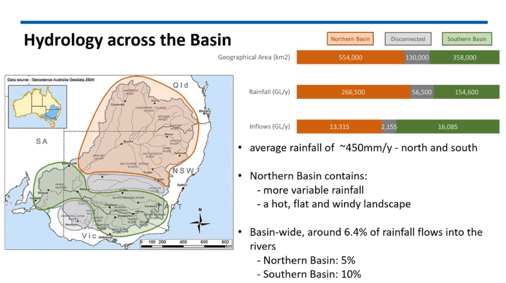
Even when private, on-farm storages are included in total storage volumes for each of the valleys this relationship between the regions remains. Northern on-farm private storages equal approximately 1,450GL (includes part of the central), together with public storages the Northern Basin represents 36% of the public storage in the Southern Basin.
Total storage volume in the Northern Basin including private on farm storages is 36% of the public* storage in the Southern Basin.
*There is an unknown quantity of private on-farm storages in the Southern Basin, as it has not been estimated since 2002.
There is also private on-farm storage in the Southern regions as well as and the Coastal. For example in the Murrumbidgee, these were estimated as part of Cap and Water Sharing Plan development, as minimal volumes of around 36GL for direct pumpers (not in the irrigation districts) and these were not actually included in the model at the time (See Cap Report). However, we know with best practice guidelines for irrigation and environmental obligations, on-farm storage has been a requirement since Cap and encouraged, it is likely to have increased. Whilst non-government reports have suggested there has been development and an increase in capacity, the volume was not quantified. There is therefore, less certainty around the estimated volumes of private on-farm storage in these regions than there is in the Northern and Central regions, due to the Commonwealth and State investment in surveys in these areas as part of the Healthy Floodplains Project.

Historical water availability, compared with inflows and allocation has also been tracked by WaterNSW. The MDBA recently
presented as part of the their webinar series, a breakdown of overall flows and storages. To view this webinar visit their Webinar
webpage.
For more information on historical water availability in the Gwydir Valley, see our page Historical Water Availability.
